
Susan's Guidebook
Sightseeing
National Trust - Steam Yacht Gondola
Lake Road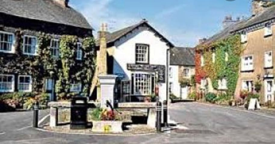
Cartmel
Independent shops and co op and Tesco.
Park and promenade.
Award winning butcher.
Nice tea shops and cafes
Good variety of restaurants
39 recommandé par les habitants
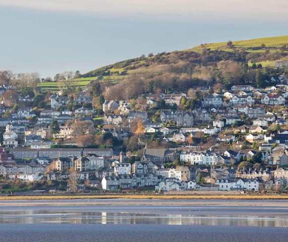
Grange-over-Sands
Independent shops and co op and Tesco.
Park and promenade.
Award winning butcher.
Nice tea shops and cafes
Good variety of restaurants
Recommended for individuals & families with children.
Check on Groupon Deals
85 recommandé par les habitants
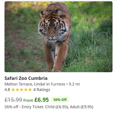
Zoo Safari de South Lakes
Melton TerraceRecommended for individuals & families with children.
Check on Groupon Deals
Historic market town with quirky independent shops, indoor Market & Saturday street market.
Ulverston
Walking
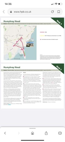
Humphrey Head
Distance - 71⁄2km (41⁄2 miles) Map: Ordnance Survey Explorer OL7, The English Lakes, South Eastern Area 1:25,000 Ascent 113m (371ft)
- Walk
- B5271 Windermere Road (leads to the A590)
1 - See attached instructions for details of points
Disclaimer:
This route was correct at time of writing. However, alterations can happen if development or boundary changes occur, and there is no guarantee of permanent access. These walks have been published for use by site visitors on the understanding that neither HPB Management Limited nor any other person connected with Holiday Property Bond is responsible for the safety or wellbeing of those following the routes as described. It is walkers’ own responsibility to be adequately prepared and equipped for the level of walk and the weather conditions and to assess the safety and accessibility of the walk.
Walk 5
Humphrey Head
Distance - 71⁄2km (41⁄2 miles) Map: Ordnance Survey Explorer OL7, The English Lakes, South Eastern Area 1:25,000 Ascent 113m (371ft)
Humphrey Head is a great mound of limestone thrusting boldly into the north side of Morecambe Bay. As the shores of the bay are generally flat, its prominence is very marked, seemingly higher than its modest 53m. (174ft). There are near vertical cliffs on the west side, woodland on the east and excellent walking along the top. Not surprisingly, The Head has acquired its share of history/ legend over the years.
A cave at the foot of the west cliffs is said to have been the home of a hermit; close by is a well of which the water has been claimed to have therapeutic properties, good for rheumatism, gout and bilious complaints. It was formerly sold to holidaymakers in Morecambe, presumably to wash down the candyfloss! England’s last wolf was reputedly killed on Humphrey Head about four hundred years ago by the son of the lord of nearby Wrayholme.
Allithwaite is a substantial village, with old buildings in the centre and a considerable suburban fringe which
just avoided merging with nearby Grange over Sands. Wraysholme Tower, now embedded in Wraysholme Farm, is a good surviving example of a pele tower, a type of fortification relatively common in Cumbria, dating from the 13th and 14th centuries, when the Scottish Border was a lawless area with frequent incursions by raiders from the north.
The circuit below links Allithwaite with Humphrey Head, much of the route using the Cumbria Coastal Way designated footpath. Although this is an easy walk, at most times of year muddy ground will be encountered and there are several stiles.
Start/car parking - Roadside spaces in Allithwaite village, grid reference 388765.
WALK
From any parking place in Allithwaite walk downhill and follow the main road heading towards Flookburgh.
1 At the Pheasant Inn turn left to follow the Cumbria Coastal Way, going to the right, downhill, at a fork below the inn. Pass to the right of the farmyard building and then an immediate right where the sign post is situated saying ‘Cumbrian Coastal Way’. The roadway soon loses its surface as it heads towards the mound of Humphrey Head.
2 After paddocks with horses turn right to leave the roadway at a waymark. Go through a squeezer stile/gate, keeping left across a muddy area to a ladder stile. Continue across the next field on the same line, passing behind large agricultural buildings to reach a footbridge over a stream and a gate. Carry on, with the stream close on the left, passing another rather wet section to reach a kissing gate. Next is a squeezer stile with signpost; cross a farm access track to a stile opposite and continue through a few trees, with the railway embankment ahead. Go through gates to pass under the railway line and approach Wyke Farm, with a little gate to the left indicating the way past the farm buildings. The faint path stays close to a wall on the right, initially muddy.
3 Turn right at a kissing gate to rise on a good track between wall and hedge, over the neck of the mound of Humphrey Head.
4 Join a surfaced lane. Turn left, then left again in 30m, through a kissing gate, passing a Cumbria Wildlife Trust information board before rising quite
steeply along a roadway for a short distance. Bear right, before the access gate to Humphrey Head Centre, rising more gently over grass along the spine of the hill, with outcropping limestone along the way. The path keeps generally to the west side, through a kissing gate, with ever expanding views over the bay.
5 AtthetrigpointwhichmarkstheHead,theviewsaretruly enormous on a clear day, with huge expanses of Morecambe Bay ahead, Arnside Knott and Heysham power station, and Lakeland fells including the Coniston range. Langdales and Helvellyn behind. Return to point 4, turning right to follow the little lane. Pass the entrance drive to Wyke Farm.
6 At a road junction in a half mile turn right, cross the railway on a level crossing and pass close to Wraysholme Tower, with an obvious pele tower forming part of the more recent structure. Pass the farm entrance drive.
7 In a further 250m. turn right at a signposted kissing gate ‘public footpath to Allithwaite’. Go over grass to another kissing gate and continue close to a stream on the left. The hill to the right is Kirkhead, crowned by Kirkhead Tower. Turn left to cross the stream on a concrete bridge*. There is more mud, then a gate giving access to a tarmac road. Turn right, then right again in 40m. to follow a roadway to Beckside hamlet. Bear left to rise and join the main Allithwaite road close to the Pheasant Inn. Return to the parking place.
*This is not shown as a right of way on the ordnance survey map. You can walk to the end of the field and in the corner easily find and follow the correct route in to the hamlet as marked on the OS map.
Refreshments - Pheasant Inn Allithwaite
Walk 5
Humphrey Head
Holy Well LaneFood scene
Cartmel Priory
The Square